Global navigation satellite system (GNSS)
Contents
Quick summary
Developed by: USA, EU, China, Russia
Date:
Type: Method
Suitable for the following measures:
Introduction
Global navigation satellite system (GNSS) is a general term describing any satellite constellation that provides positioning, navigation, and timing (PNT) services on a global or regional basis. While GPS is the most prevalent GNSS, other nations have provided their own systems to provide complementary, independent PNT capability. GPS is often used as a synonym for all of the different systems (Table 1).
|
System |
BeiDou |
Galileo |
GLONASS |
GPS |
|
Owner |
China |
European Union |
Russia |
United States |
|
Coverage |
Regional, global by 2020 |
Global by 2020 |
Global |
Global |
|
Status |
Basic service by 2018, to be complete by H1 2020 |
Operating since 2016, 2020 completion |
Operational |
Operational |
|
Precision |
10 (public) 0.1m (encrypted) |
1m (public) 0.01m (encrypted) |
4.5m - 7.4m |
15m (no DGPS or WAAS) |
Application
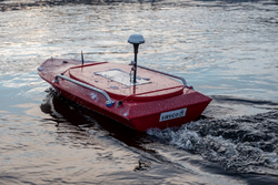
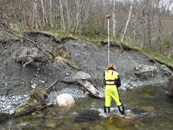
GNSS systems are used to georeferenced measurements. It is usually used in connection with other systems, such as ADCP, Drones, devices for monitoring fish migration, and other devices where the exact location is important.
It is important to be aware of the accuracy of the GNSS data and if it fits the measurement. For bathymetry measurements it is recommended to have accuracy within a few cm, while discharge measurements can be done with accuracy at the submeter level.
There are mainly three different types of GNSS accuracy:
- Standard, such as in cell phones and car navigation. The accuracy lies within 3-5 m horizontally and 5-20 m vertically. These systems don’t receive any correction signal.
- Advanced receivers, usually referred to as “differential GPS”. These are used in most scientific instruments. The accuracy lies below 1 m horizontally and 2 m vertically.
- RTK-GPS need an internet connection to receive a correction signal. This usually is a real time signal (RTK = Real Time Kinematic), but it is also possible to get the correction for post processing.
Other information
General accuracy is depending on
- Number of satellites / selective availability
- Angle between the satellites = Dilution of Precision (DOP)
- Reflection from buildings/obstacles = multipath error
- Atmospheric conditions
Only the last point, the atmospheric conditions, can be corrected with the differential and RTK GPS.
Relevant literature
- https://en.wikipedia.org/wiki/Satellite_navigation
- https://eos-gnss.com/elevation-for-beginners
- https://www.e-education.psu.edu/geog862/node/1828
- https://gisgeography.com/gps-accuracy-hdop-pdop-gdop-multipath/

