File:Adcp wse.png
Revision as of 08:58, 2 October 2020 by Ismailalbayrak (talk | contribs)
Adcp_wse.png (731 × 312 pixels, file size: 15 KB, MIME type: image/png)
| Description |
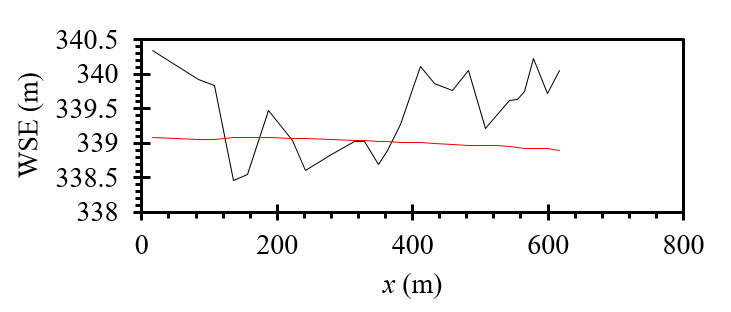
Water surface elevation along the power canal of HPP Schiffmühle (black line: DGPS data and red line: total station data). |
| Author |
Mohammad Reza Maddahi |
| Source |
VAW of ETH Zurich |
File history
Click on a date/time to view the file as it appeared at that time.
| Date/Time | Thumbnail | Dimensions | User | Comment | |
|---|---|---|---|---|---|
| current | 13:05, 18 June 2019 |  | 731 × 312 (15 KB) | Bendikhansen (talk | contribs) |
- You cannot overwrite this file.
File usage
The following page uses this file:
