Complete or partial migration barrier removal
Contents
Introduction
If connectivity is to be restored, it should initially be considered whether the migration barrier can be removed. It is often the best and most long-term solution if the goal is to recreate connectivity. Here, the solution focuses on rivers regulated for hydropower production where dams will basically be maintained, but also in other regulated rivers there are possibilities for removing obstacles. Only in the Alpine region of Europe, a large number of dams have been built for river bed stabilization, and many of these have been replaced by block ramps, complete or partial removed. In addition, smaller weirs have been removed in residual flow reaches or minimum flow reaches with great success (Fjeldstad et al. 2012).
Methods, tools, and devices
During planning
Planning of fish barrier removal will start with mapping and surveying of the barrier itself and the river reach upstream and downstream of the barrier. This includes measurements of water covered area, water edges and river slope and the bathymetry of the area. Geographic data should be handled in GIS software for further planning and analyses. The construction planning should be supported with simple hydraulic modelling or calculations, such as the models River2D, HEC-RAS 2D, OpenFoam or Telemac 2D and 3D (see Chapter 9.1 for references). The physical adjustments should then be planned according to the hydraulic calculations, assuring a stable bottom substrate and hydraulic conditions suitable for fish migrations.
During implementation
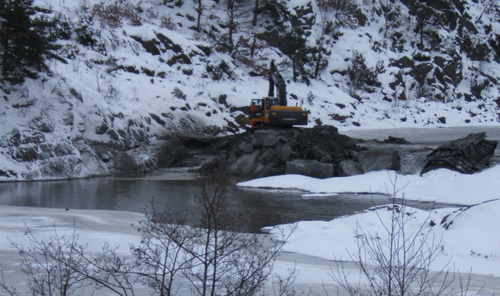
Physical implementation of migration barrier removals requires heavy machinery suited for the river size and its surrounding terrain, such as excavators and lorries. It must be considered how the different parts of the barrier, such as rocks and boulders, can be used as elements in the new habitat. Under normal conditions, none or only small volumes of substrate need to be transported to or from the construction site. Here, it is crucial that the labor involved has the relevant experience to make the best decisions while adjusting the physical habitat and that they have the required understanding of the planning documents and purpose of the measures
During operation
Physical habitat measures in regulated rivers must often be maintained to ensure that functions related to flow and sediments are restored, such as flood events and connectivity of the sediments. The frequency of the maintenance will be very site-specific.
Classification table
| Classification | Selection |
|---|---|
| Fish species for the measure | All |
| Does the measure require loss of power production | - |
| - | |
| Structural (requires no additional flow release) | |
| Recurrence of maintenance | Irregular at events |
| Which life-stage of fish is measure aimed at | - |
| - | |
| - | |
| - | |
| - | |
| Movements of migration of fish | |
| Which physical parameter is mitigated | Flow quantity |
| Flow variations | |
| Substrate and hyporheic zone | |
| Water temperature | |
| Ice | |
| Water velocity | |
| Water depth | |
| Hydropower type the measure is suitable for | Plant in dam |
| Plant with bypass section | |
| Dam height (m) the measure is suitable for | Up to 20 |
| Section in the regulated system measure is designed for | - |
| Bypass section | |
| - | |
| River type implemented | Steep gradient (up to 0.4 %) |
| Fairly steep with rocks, boulders (from 0.4 to 0.05 %) | |
| Slow flowing, lowland, sandy (less than 0.05 %) | |
| Level of certainty in effect | Moderately certain |
| Technology readiness level | TRL 9: actual system proven in operational environment |
